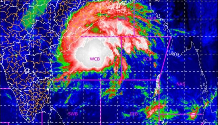
Insight Bureau: The deep depression in the Bay of Bengal has intensified into a Cyclonic Storm on Friday afternoon, according to the Indian Meteorological Department. IMD director general Mrutunjay Mohapatra told a media briefing that the present wind speed of the cyclonic storm, currently about 420 km south-southeast of Vishakhapatnam, is between 60-70 kmph gusting ton 80 kmph.
Mohapatra said that Cyclone Jawad is moving north-northwest and is expected to change the route and make landfall near Odisha’s Puri on Sunday noon. By Saturday morning, Cyclone Jawad is likely to reach the west-central Bay of Bengal off North Andhra Pradesh and Odisha coast, the area which is expected to witness the maximum impact.
Support Independent Journalism? Keep us live.
IMD has suggested a total suspension of fishing operations and urged people in affected areas to remain indoors. The Met department said that there must be regulated traffic in the cyclone area and movement should be restricted.
Atul Karwal, director-general of the National Disaster Response Force, said that a total of 46 NDRF teams have been prepositioned in Odisha, West Bengal and Andhra Pradesh. 18 teams have been kept in reserve. Tidal waves expected to reach 4-5 mts. Intensity of the cyclone Jawad will be more than Gulab and less than Titli, he added.


Comments are closed.