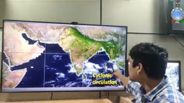
Cyclonic Storm approaching Odisha Coast
The Windy and the Skymet had confirmed that cyclonic circulation over the North Andaman Sea and neighbourhood will intensify into low-pressure and then a cyclonic storm.
Insight Bureau: A low-pressure area is very likely to form over the north Andaman Sea and neighbourhood in the next 36 hours the India Meteorological Department said on Sunday.
It is likely to become marked and move west-northwestwards towards south Odisha-north Andhra Pradesh coasts in the subsequent 4-5 days.
Under its influence, light to moderate rainfall at most places with isolated thunderstorm (wind speed 40-50 kmph gusting to 60 kmph) and heavy to very heavy falls very likely over Andaman & Nicobar Islands during next 5 days.
The Windy and the Skymet had confirmed that cyclonic circulation over the North Andaman Sea and neighbourhood will intensify into low-pressure and then a cyclonic storm.
Support Independent Journalism? Keep us live.
The IMD had also confirmed that be it a low pressure or a cyclonic storm, the system will make landfall in coastal Odisha.
According to the NCEP-GFS forecast, the developed system will intensify into a cyclone by October 16 and may cross the coast between Srikakulam (Andhra Pradesh) and Gopalpur (Odisha) coast on and around October 17.
#Weather briefing by Scientist-C: Umasankar Das for next five days, based on 0830 Hrs IST observation of #10th October, 2021.https://t.co/Bvu5t1cVT1 pic.twitter.com/UObQE0zt80
— Meteorological Centre, Bhubaneswar (@mcbbsr) October 10, 2021


Comments are closed.