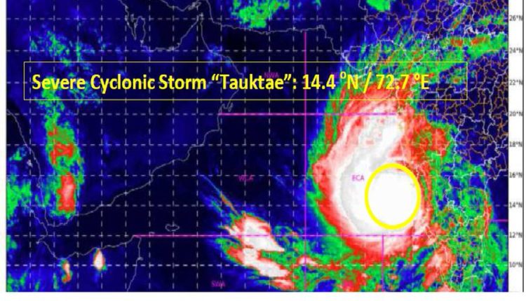
Cyclone Tauktae intensified into a Severe Cyclonic Storm
It is likely to intensify further into a very severe cyclonic storm in next 12 hours
TNI Bureau: The Cyclonic Storm Tauktae has intensified into a severe cyclonic storm over east central Arabian Sea, Sunday morning and is very likely to intensify further into a very severe cyclonic storm in next 12 hours.
According to Indian Meteorological Department’s (IMD) latest evening bulletin, Cyclonic Storm Tauktae over east Central Arabian Sea moved nearly north wards with a speed of about 12 km ph during past six hours and intensified into a Severe Cyclonic Storm Saturday night.
It’s located at about 150 km southwest of Panjim-Goa, 490 km south of Mumbai, 730 km SSWest of Veraval (Gujarat). It may cross Gujarat coast between Porbandar & Mahuva (Bhavnagar district) around 18th May early morning.
It is likely to intensify further into a Very Severe Cyclonic Storm during next 12 hours. Then it will move north-northwestwards and reach Gujarat coast in the morning of May 18, IMD said.
The IMD has predicted that the entire western coast of India will experience intense rainfall activity and onshore winds over the next 3-4 days. The wind speed may reach up to 175 km ph around May 18 afternoon or evening during its landfall over Gujarat between Porbandar and Naliya.
Sea conditions will be very rough over southeast Arabian Sea and adjoining Lakshadweep – Maldives area & equatorial Indian Ocean during next 12 hours.
On the other hand, PM Narendra Modi, on Saturday reviewed preparedness on cyclone Tauktae and asked officials to take all measures to ensure people are safely evacuated.


Comments are closed.