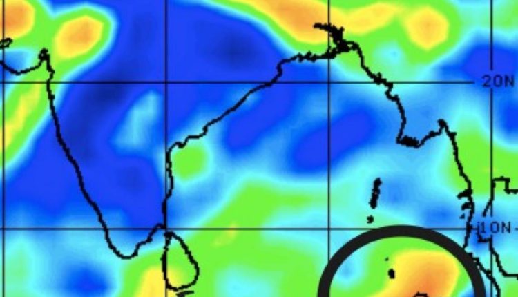
Cyclone Update: Low Pressure likely by May 6
A Low-Pressure Area is predicted to emerge over the same region about May 6, becoming more pronounced over the next 24 hours, IMD informed.
Insight Bureau: A cyclonic circulation is expected to emerge over the South Andaman Sea and the surrounding area around May 4, according to the Meteorological Centre in Bhubaneswar. Under the influence, a Low-Pressure Area is predicted to emerge over the same region around May 6, becoming more pronounced over the next 24 hours, IMD informed.
Various meteorological models suggest that the low-pressure system would grow into a cyclone and pass through the Odisha-West Bengal coast around May 10. However, the IMD has not yet projected the cyclone’s route or landfall.
A #CyclonicCirculation has formed over South Andaman Sea & neighbourhood and extends upto mid tropospheric levels. Under its influence, a #LowPressureArea is likely to form over the same region around #6th May. It is likely become more #marked during subsequent #24hours.
— Meteorological Centre, Bhubaneswar (@mcbbsr) May 4, 2022
Support Independent Journalism? Keep us live.
The weather service anticipates that a good picture of the probable cyclone’s track will be available by May 7. Furthermore, if the cyclone circulation moves towards Odisha, districts such as Kendrapara, Bhadrak, Jajpur, Balasore, Mayurbhanj, and Keonjhar are expected to be affected.
The Meteorological Department has expected rainfall and severe winds in parts of Odisha, Bihar and Jharkhand over the next three to four days.
It further informed, there will be a typhoon-like condition with rainfall in most portions of Northeast India, West Bengal, and Sikkim owing to the influence of southwesterly winds from the Bay of Bengal.


Comments are closed.