TNI Bureau: A cyclonic storm is expected to make landfall along the coastlines of Odisha and West Bengal on Thursday, according to the India Meteorological Department (IMD).
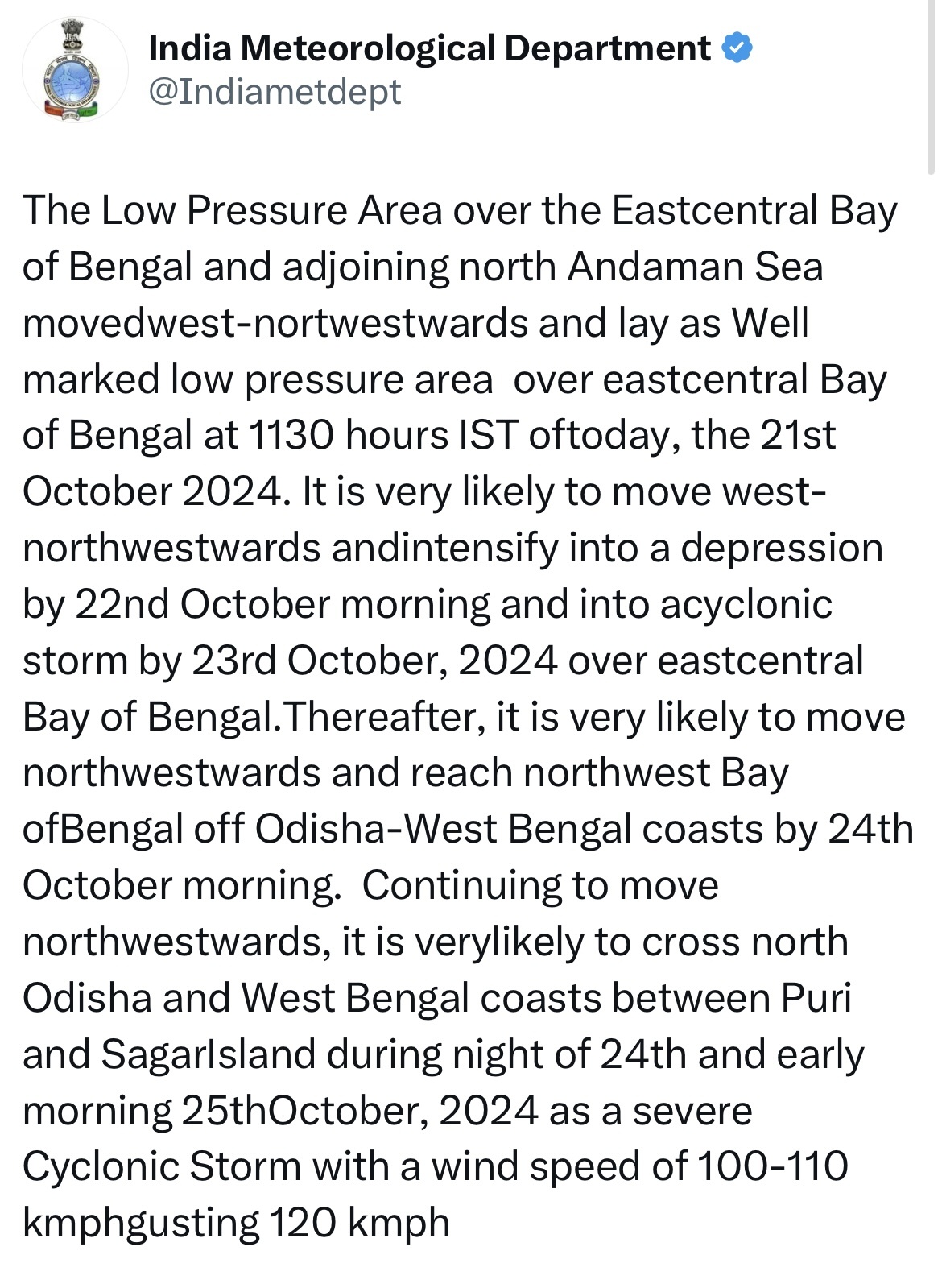
Gusty wind intensity is predicted to escalate, reaching 100-110 kmph, with gusts up to 120 kmph, from the night of October 24 (Thursday) into the morning of October 25. It is very likely to cross North Odisha and West Bengal coasts between Puri and Sagar Island during night of October 24 and early morning of October 25 as a severe Cyclonic Storm.
A low-pressure area has formed over North and Andaman and it’s adjoining East Central Bay of Bengal likely to further intensify into a Depression in next 24hours.
The Low-Pressure area formed over the Eastcentral Bay of Bengal and adjoining north Andaman Sea very likely to move west-northwestwards and intensify into a depression by October 22 morning and into a cyclonic storm by October 23 over East Central BoB.
Thereafter, it is very likely to move northwestwards and reach northwest BoB off Odisha-West Bengal coasts by October 24 morning.
Meanwhile, the district administrations have started all kinds of preparations in full swing. Residents of Balasore, Bhadrak, Puri and Gopalpur coasts have been advised to remain alert ahead of possible Cyclone Dana.
All the cyclone shelter centers across Odisha have been kept fully ready. ODRAF, NDRF team and fire service personnel have been kept on alert. If needed, people will be evacuated to safer places much in advance, said Revenue Minister Suresh Pujari.